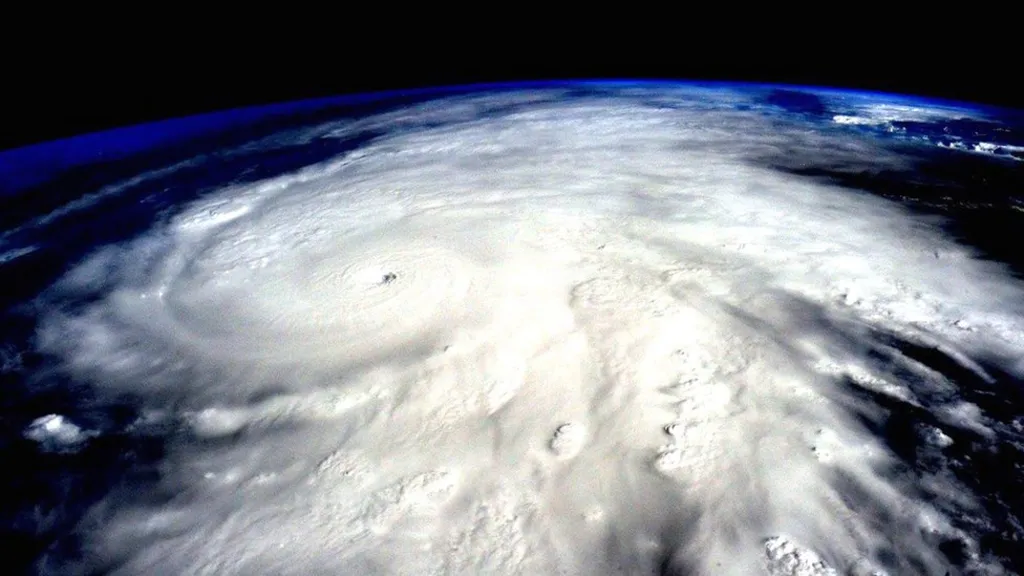
The United States of America is exposed annually to natural disasters of unprecedented proportions due to climate change. The devastating fires spread across California's forests in 2019 and had significant environmental, economic and social impacts. That's why the U.S. government has formed a White House executive team. His mission was to develop better means to protect the country and its key infrastructure such as the power grid. At the National Laboratory for the Pacific Northwest (PNNL), With the support of several ministries, Researchers used artificial intelligence and cloud computing to improve image analysis techniques. This is done with the aim of employing disaster prediction techniques and accelerating response to them.
In general, many parts of the world are exposed to the risks of natural disasters. whose proportions and intensity vary from place to place, This has devastating humanitarian, economic and environmental impacts. For this reason, Many governments are strengthening their technical capacity and using technology to predict, respond to and mitigate these disasters.
In recent years, America has seen an increase in the frequency of disasters such as wildfires, floods and others. In 2020 alone, Fires have consumed more than 10 million hectares of the country. That's three times the fires it experienced between 1990 and 2000 combined. In addition to the loss of life and trees and the destruction of ecosystems caused by those disasters, These fires have caused significant financial losses to the government, communities and entities involved in responding to them. Its losses exceeded $170 billion in 2020. Without counting the losses of other natural disasters such as hurricanes and earthquakes. This is instead of disrupting vital service facilities such as power stations, Which may result in damage to other facilities such as power outages for several days, Which causes a total halt in public life.
All of this prompted the U.S. government to establish a team of government, industry, and academic experts to develop innovative ways to contain the effects of natural disasters by employing predictive technologies. The project was supported by several government bodies, It is the Department of Homeland Security and the Department of Defense through its Artificial Intelligence Center, Office of Cybersecurity, Office of Energy Security, Emergency Response Office, As well as the Office of Artificial Intelligence and Technology of the Department of Energy. The result of this collaboration was the launch of a collaboration with the National Laboratory for the Pacific Northwest (PNNL), Researchers are scaling up Rapid Disaster Analysis and Response (RADR) operations by developing image analysis techniques and identifying the most appropriate response models to contain damage to key energy infrastructures.
The work of the project team is based on assessing the damage of natural disasters such as forest fires, floods, hurricanes, storms, earthquakes and others. and predicting all these factors, By employing several technologies such as satellite images and drones, Besides artificial intelligence and cloud computing.
This project began a few years ago with the creation of an algorithm that analyzes several types of satellite imagery and then investigates any changes on the ground after a disaster. In order to conduct a rapid assessment of their material damage, Before entering the field teams to carry out assistance and repair operations. In order to make the damage assessment process faster, The team then included new sources of imagery, Such as local and global government satellites, which are open sources of data, and those commercial covered by the International Disaster Charter (IDC), And even what the public posts on social media platforms, While aerial photographs may show damage to power plants or transmission lines, for example, Ground images can confirm or deny this. Once the images arrive, The disaster analysis and rapid response system can analyze them in about 10 minutes.
In cases of fire, The team collects and analyzes images with weather data to predict the possible outcome of the size and trajectory of the fire. Wind, vegetation and any material that fuels a fire can affect the size and direction of a fire.
Sometimes, Fire smoke or cloud condensation may be an obstacle to visibility and image analysis. To overcome this challenge, The team has enhanced the disaster analysis and rapid response system with the infrared feature, Which provides a clearer view of natural spaces and enables those concerned to choose the safest locations for the stationing of relief teams.
Considering the dispersed local, regional and national resources required by disaster response coordination processes, The challenge of transferring data fast enough and in a format that can be accessed and interpreted without complications arises, Especially in environments where connectivity is weak or limited. For this reason, The cloud computing system provided a direct network to obtain available images, process analytics and share data via browsers or mobile phone in a way that is easy for stakeholders to follow and understand.
In addition to its usefulness in shortening the time required for disaster data analysis and rapid response, The use of artificial intelligence can reduce the impact of wildfires and protect energy infrastructure. And most importantly saving lives, therefore, It can make a real difference in extreme weather conditions, Like the season of wildfires. Analytical algorithms provide a quick assessment of the post-disaster phase, The use of multiple data sources shortens response time from days to hours and makes assessments more integrated, accurate and variable-friendly. Accordingly, The system of analysis and rapid response to disasters contributes to providing an accurate view of the movement of any natural disaster, Empowering those involved in responding to disasters by taking optimal measures to contain the damage, and better manage resources.
References:
https://opengovasia.com/adoption-of-ai-cloud-for-disaster-response-and-mitigation-in-the-u-s/


